Latest Episode: Circumnavigating the Wilson Globe

James Wilson is an almost mythical figure in Vermont History, reputedly a lone genius who created the first globe in America. For several years, the Vermont Historical Society researched more about Wilson and his globes – and the picture that emerged was much more complicated and interesting than the legend.
Image courtesy of Library of Congress
About the Show
Before Your Time is produced by the Vermont Historical Society and Vermont Humanities. Every episode, we go inside the stacks at the Vermont Historical Society to look at an object from their permanent collection that tells us something unique about our state. Then, we take a closer look at the people, the events, or the ideas that surround each artifact.
Recent Episodes

Circumnavigating the Wilson Globe
James Wilson is an almost mythical figure in Vermont History, reputedly a lone genius who created the first globe in America. For several years, the Vermont Historical Society researched more about Wilson and his globes – and the picture that emerged was much more complicated and interesting than the legend.
Acid Rain and Vermont’s Waterways
Vermont’s water quality has long been a top concern for scientists and residents, and in the 1980s it reached national attention as acid rain came to the forefront of public understanding. What is acid rain, anyway? Why was Vermont getting so much attention? And where are we now in addressing those challenges?
The Library Map of Vermont
The “Library Map of Vermont” was created in 1914 to track all 225 brick and mortar libraries as well as 267 traveling library stations around the state. In this episode we’ll ask; Can a map truly show what it means for a community to have a well-supported library… and when communities lack that?
Forests and Frontiers
Vermont’s extensive old-growth forests drew representatives from the King’s Navy looking for mast trees. What can their map of timber resources tell us about our relationship to the land, how Vermont defined itself, and how history is saved or not?
Canal Fever
In the summer of 1829, three Army surveyors created a map exploring a potential canal route that would have connected Lake Champlain and the Connecticut River. “Canal Fever” was gripping the region, with the success of the Erie Canal. But this quantum leap in transportation technology would have to contend with an even bigger idea: the railroads.
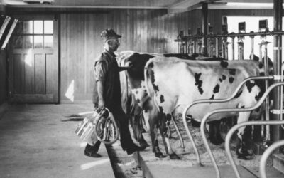
Call it A New Life
Technological improvements, from butter churns to electricity, transformed life on Vermont farms from the 1890s through the mid-20th century. Many of these changes eased the workload of Vermont’s farming families. But other changes – done in the name of modernity – had long-term impacts on the future of dairy in our state.