by Ryan Newswanger | Sep 4, 2024 | Episodes
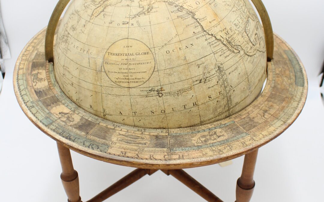
Circumnavigating the Wilson Globe James Wilson is an almost mythical figure in Vermont History, reputedly a lone genius who created the first globe in America. For several years, the Vermont Historical Society researched more about Wilson and his globes – and...

by Ryan Newswanger | Aug 8, 2024 | Episodes
Acid Rain and Vermont’s Waterways Vermont’s water quality has long been a top concern for scientists and residents, and in the 1980s it reached national attention as acid rain came to the forefront of public understanding. What is acid rain, anyway? Why...
by Ryan Newswanger | Jul 22, 2024 | Episodes
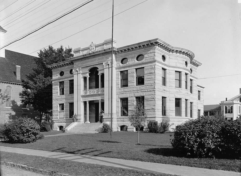
The Library Map of Vermont The “Library Map of Vermont” was created in 1914 to track all 225 brick and mortar libraries as well as 267 traveling library stations around the state. In this episode we’ll ask; Can a map truly show what it means for a community to have a...

by Ryan Newswanger | May 23, 2024 | Episodes
Forests and Frontiers Vermont’s extensive old-growth forests drew representatives from the King’s Navy looking for mast trees. What can their map of timber resources tell us about our relationship to the land, how Vermont defined itself, and how history is...
by Ryan Newswanger | Apr 18, 2024 | Episodes
Canal Fever In the summer of 1829, three Army surveyors created a map exploring a potential canal route that would have connected Lake Champlain and the Connecticut River. “Canal Fever” was gripping the region, with the success of the Erie Canal. But this...
by Ryan Newswanger | Sep 21, 2023 | Episodes
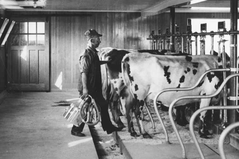
Call it A New Life Technological improvements, from butter churns to electricity, transformed life on Vermont farms from the 1890s through the mid-20th century. Many of these changes eased the workload of Vermont’s farming families. But other changes –...